Dollar The Dollar Lake Fire is currently 13,449 acres and 8% containment.
By SVI Staff
August 27, 2025

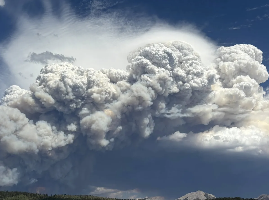
The towering smoke column from the Dollar Lake Fire as seen early in the forest fire’s development. (Kendell Valley Lodge) Via WyoFile.com
VIDEO COURTESY OF THE U.S. FOREST SERVICE –
While area residents have been understandably engaged in the Willow Creek Fire south of Smoot, the Dollar Lake Fire near Pinedale surpassed 13,000 acres on the last estimate by forest officials and is listed at 8% containment as of Wednesday, August 27.
The latest information indicates that firefighters took advantage of a break in the weather yesterday to secure problem areas on the south and east sides of the fire including around campgrounds, outfitter camps and around the Red Cliff Bible Camp. Crews also continued to build containment and contingency lines, especially on the south side of the fire area.
Increased rain in western Wyoming continues to aid in multiple fire suppression efforts, however gusting winds and lightning are still a threat according to fire experts.
EVACUATIONS:
Go (Evacuation Order) Status:
A five-mile radius around Dollar Lake in the Green Lakes area.
The Red Cliff Bible Camp in Cora, WY.
Set (Be Prepared to Evacuate) Status:
All residences on Moose Gypsum Road, Hill Road, Valley View Trail, Hecox Road, Pine Drive; Rock Creek
Road, Brookie Lane, White Point Road, Rainbow Drive, Trout Drive, Cutthroat Drive, and River Road; Cattle
Drive Lane, Terrace Drive, Half-way Drive; all residences off Galley Lane; and all residences along US Hwy
352 South to Richard Lane.
Ready (Monitor) Status:
Areas south of Richard Lane.
For evacuation information please go to: https://www.facebook.com/SubletteSheriff
CLOSURES:
The Bridger-Teton National Forest has issued a closure order for the Dollar Lake Fire area. Effective immediately,
the closure area encompasses the Forest east and south of Green River above its Junction with the Union Pass
Road (FS600). Where the Green River exits Green River Lake, the lake shore becomes the boundary along to
the south where it meets the Bridger Wilderness boundary. From there it follows the Wilderness boundary south
to the South Fork of Gypsum Creek. Then it follows the South Fork of Gypsum Creek southwest to State Highway

